

The live map for your Maximo Work.
Naviam GIS MapEngine 是一款功能强大、以 ArcGIS 为中心的 Maximo 制图解决方案,旨在提供快速、交互式和可扩展的空间可视化。MapEngine 专为 ArcGIS 与 Maximo 无缝集成而构建,可增强性能、可用性和可访问性,使团队能够做出更好的数据驱动决策。
地图引擎
为什么选择 Naviam GIS MapEngine?

专为现实工作流程而构建
专为现场和办公室用户设计,可以轻松地在地图上管理工作订单、服务请求和资产,而不会增加复杂性。

完全可定制
量身定制地图视图、过滤器和搜索选项以满足您组织的独特需求,无需严格的 “一刀切” 设置。

灵活且以用户为导向
使用可适应不同工作流程的可配置工具,使用户可以控制他们与空间数据的交互方式。

强大的工单可视化
根据优先级、资产类型或状态动态显示和筛选工单和服务请求,确保正确的数据始终处于中心位置。

无缝集成
无需额外的软件或第三方扩展即可使用现有的 GIS 数据和配置。

针对效率进行了优化
路线优化、批量选择和适合移动设备的访问确保团队能够更快、更智能地完成工作。

Search and filter anything
Search GIS features by layer and attribute. Filter work by priority, asset type, or status

Web-based and mobile-friendly
Runs in any browser on any device, for planners in the office and crews in the field
谁从 Naviam GIS MapEngine 中受益?
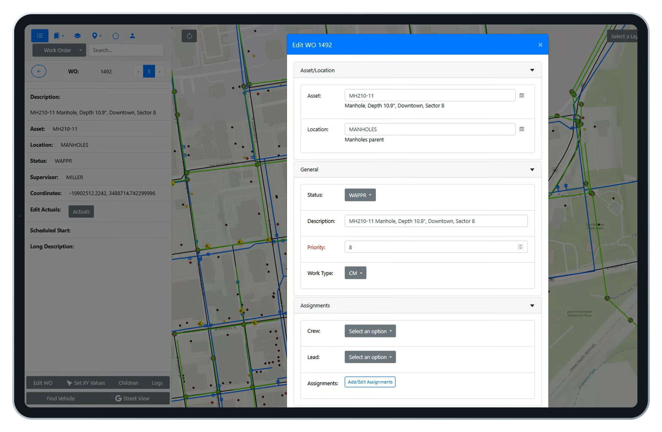
Work orders on the map open as editable forms. Change status, assign a lead, set a work group. Lasso an area and update dozens of work orders at once, the way crew chiefs plan a day.
Work orders rendered from Maximo, not Esri.
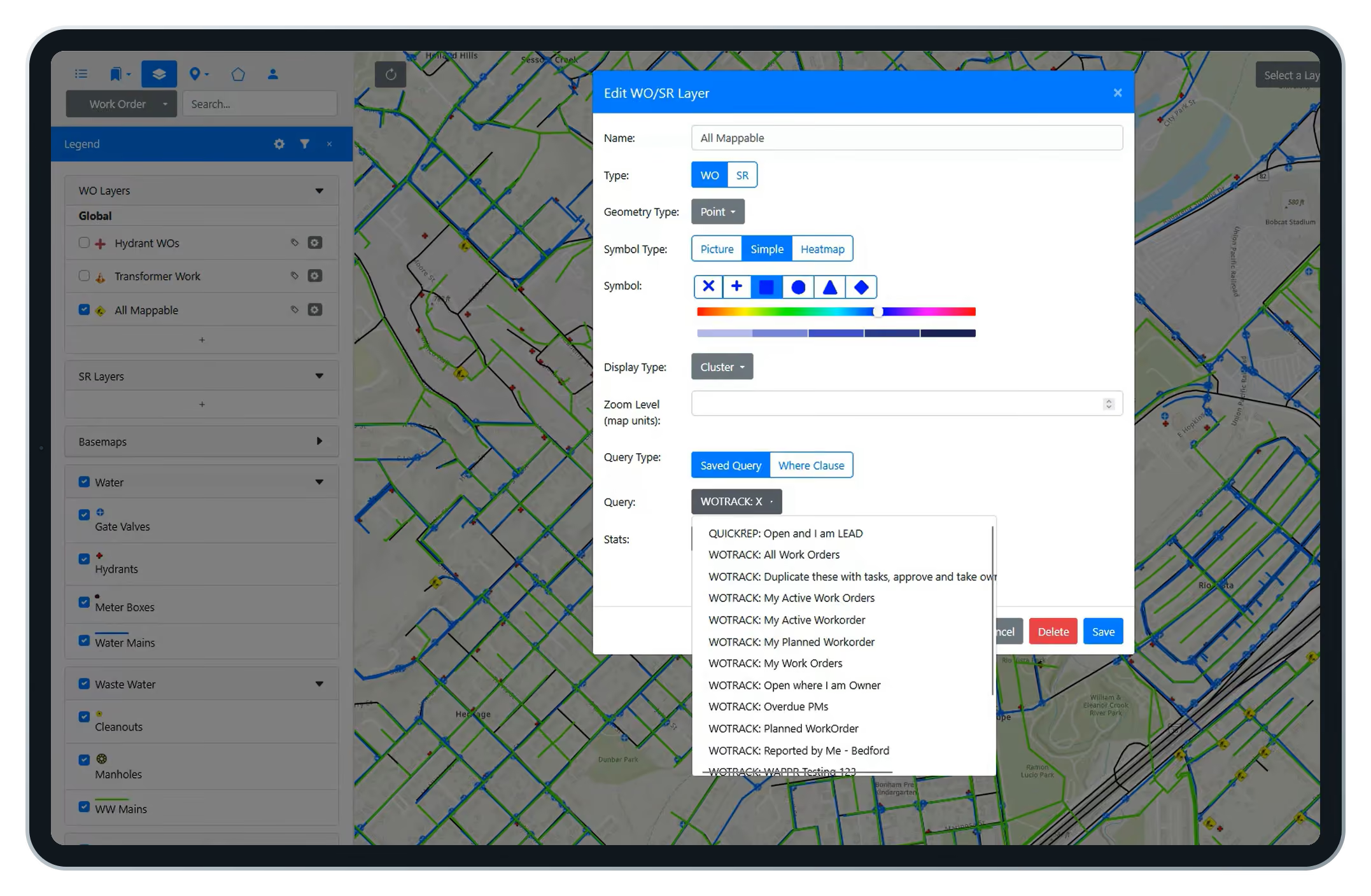
Because MapEngine draws work from Maximo data, any user can define a map layer with a saved query, style its symbols, and share it with a crew or security group. No waiting on a GIS administrator.
See Maximo routes in sequence. Then improve them.
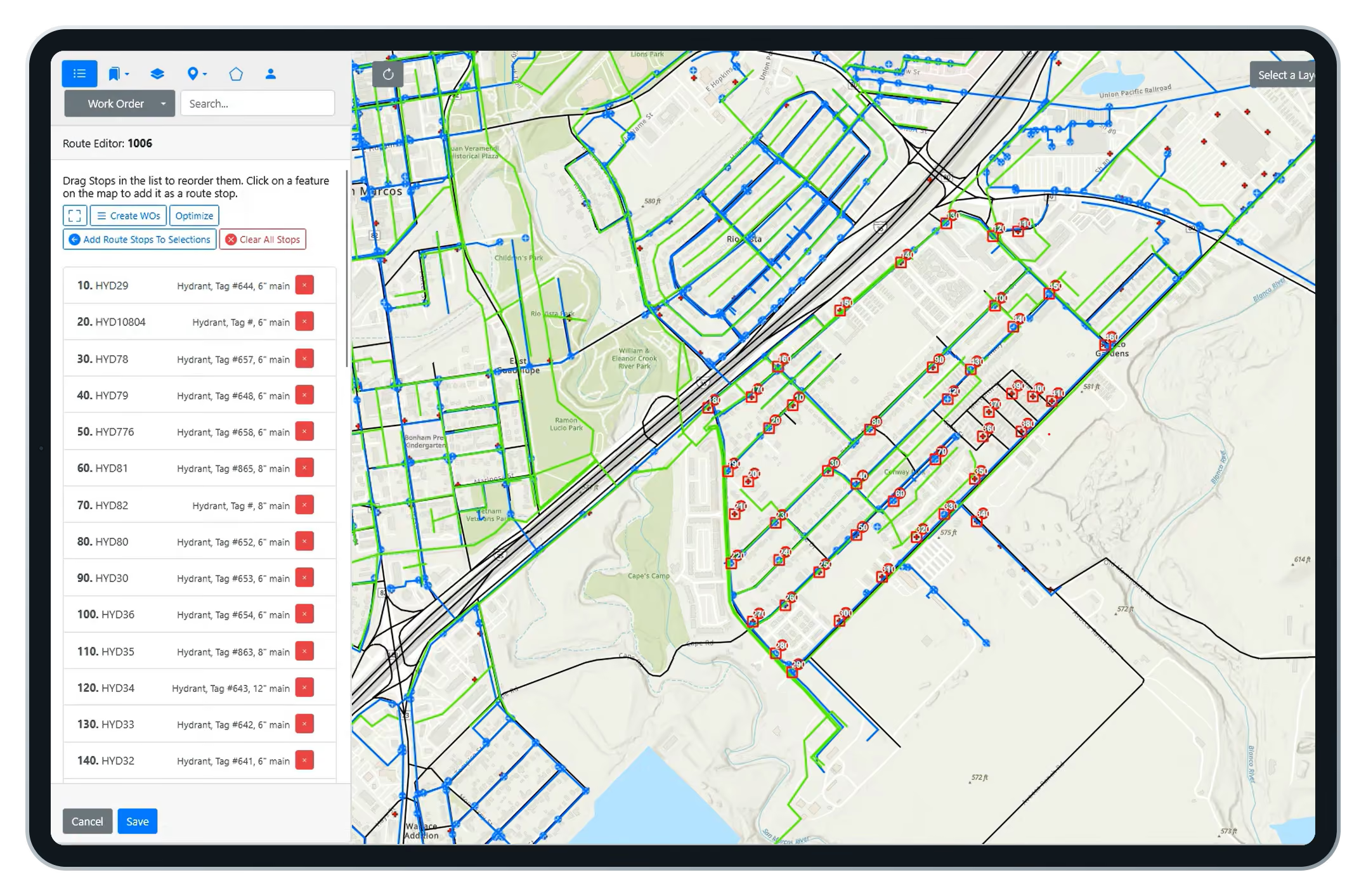
MapEngine plots a route's assets in order, so the sequence is finally visible. Pick a new start point and MapEngine proposes an optimized order you can save back to the route.
MapEngine or Maximo Spatial?
What the map can do depends on what powers it.
Who benefits from MapEngine?

Electric utilities
Transformer and pole work, visualized by feeder and by crew

Water and wastewater
Hydrants, mains, and manholes, with routes sequenced the way water flows

Cities and municipalities
One Maximo, many departments, each with its own map profile

Transportation and campuses
Airports, transit agencies, campuses, and gas. Any Esri-invested organization running IBM Maximo
Field workers and crews
Locate assets, update work orders, and follow optimized routes
Supervisors and dispatchers
Assign work by location and monitor progress
GIS and asset managers
Keep spatial data accurate and balance workloads
Maximo admins and IT
Manage integrations with less manual intervention
Executives
Use spatial insight for planning and resource allocation
Frequently Asked Questions
What is Naviam GIS MapEngine?
MapEngine is a GIS mapping application that connects Esri ArcGIS with IBM Maximo so teams can see, edit, and act on assets, work orders, and routes from a live map.
How is MapEngine different from Maximo Spatial?
MapEngine installs and updates without Maximo downtime, offers WYSIWYG configuration, per-team map profiles, self-service work order layers, editable work orders on the map, and route optimization.
How long does MapEngine take to install?
The application installs in an afternoon or less. If your GIS already carries Maximo IDs, you can be up and running in a day. Data readiness sets the timeline, not the software.
Can MapEngine be customized for different teams and workflows?
Yes. MapEngine supports configurable map views, filters, search options, layer visibility, editing permissions, and other controls so organizations can tailor the experience for field, office, operations, and GIS users.
Does installing MapEngine require Maximo downtime?
No. A one-time database configuration adds a few fields. Maximo never goes down, and updates and hotfixes can ship at any time.
Does MapEngine work with existing ArcGIS and Maximo configurations?
Yes. MapEngine uses your existing ArcGIS data and Maximo configuration. It needs no third-party extensions and no major changes to either system.
Is MapEngine mobile-friendly?
Yes. MapEngine is web-based and runs on any device, for office planning and field execution alike.
Where do the work orders on the map come from?
From Maximo, not Esri. XY coordinates live on the work order and service request tables, so any user can define map layers with a Maximo saved query.
Do I need PowerSync to use MapEngine?
Yes. MapEngine is web-based and runs on any device, for office planning and field execution alike.PowerSync populates the XY coordinates and GIS reference fields MapEngine relies on. They are designed to work together and most customers deploy both. See PowerSync.
See your Maximo data in a whole new way.
See your Maximo data in a whole new way.
Discover how Naviam GIS MapEngine transforms spatial insights into action—schedule a demo today.

